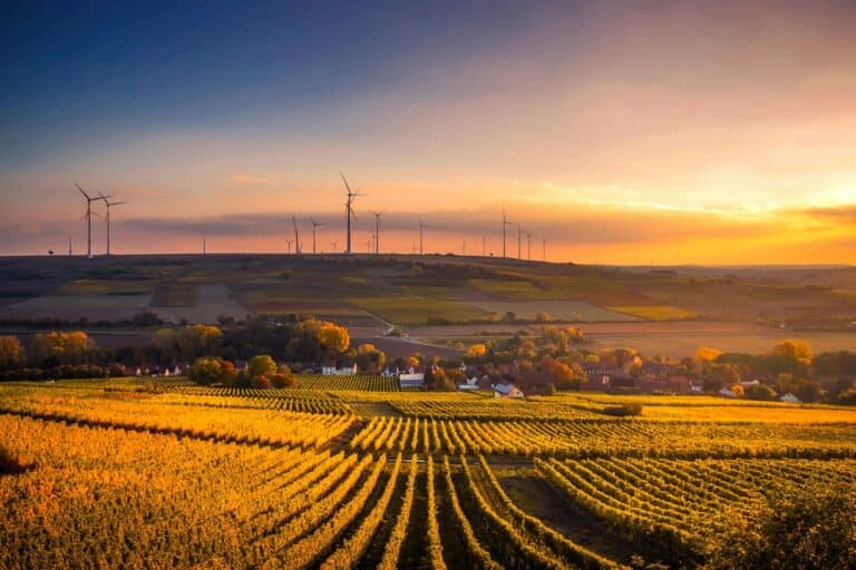
With multi-year spells of severe drought and decades of groundwater depletion affecting regions across the United States, water rights as they pertain to land use and ownership are a hot topic within the land and farming sectors.
A December 2015 investigation by USA TODAY into the state of U.S. aquifers found that average water levels have decreased more than 40 feet since 1995 for 13 counties in Texas, New Mexico, Mississippi, Kansas and Iowa. Nationwide, according to the report, waters levels have declined for 64 percent of wells tracked in a government database over the past two decades.
For land buyers, other water-related factors including flooding and the impact of severe weather events further drive the need for accurate and detailed water information at the property and local level.
Advanced mapping tools on Lands of America, including full integration with software from TerraStride Pro and MapRight, allow sellers to list out such features as wells, ponds and rivers. Sellers can also take full advantage of out-of-the-box features from Google Maps as well as MyTopo overlays to show prospective buyers features such as flood plains and area terrain. In fact, a recent Lands of America survey found that both land buyers and sellers consider mapping tools as one of the three most important tools in the land research and acquisition journey.
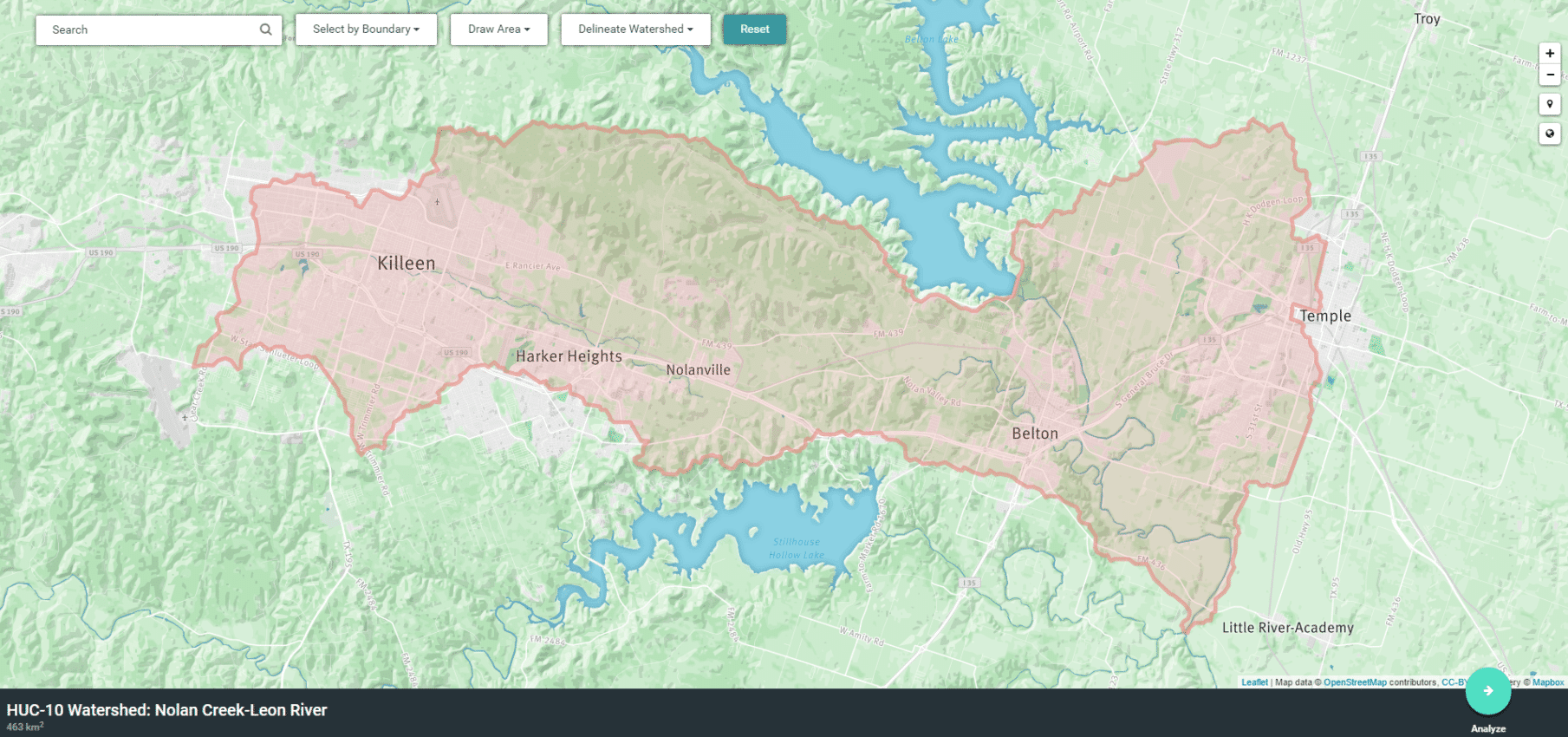
Information is power, of course, which is why we are also recommending the Stroud Water Research Center’s “Model My Watershed” tool as part of our new series profiling innovative technology that’s helping land buyers and sellers.
Model My Watershed is a free Web application that allows users to visualize area watersheds down to the county and neighborhood level, then run scenarios to model the impact of stormwater runoff based on such things as precipitation levels and soil conditions. Useful applications could be for developers and landscapers hoping to understand runoff impacts on a specific parcel of land, or land managers hoping to analyze long-term grazing and crop demands as they relate to watershed-conservation considerations.
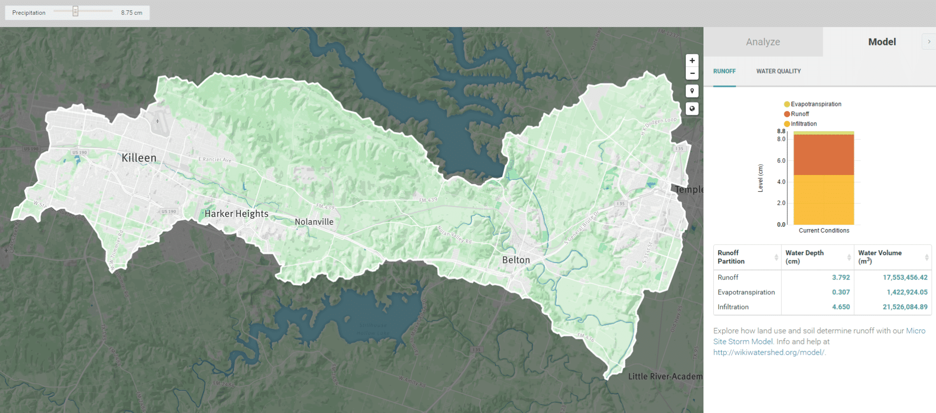
The free Model My Watershed application is an open-source project developed by the Pennsylvania-based Stroud Water Research Center, an organization dedicated to understanding the ecology of streams, rivers and their watersheds.
Tech We Like is an ongoing series profiling new technology and software of interest to our community of land buyers and sellers. Let us know in the comments section or email us via the contact form if you have other land apps or software that you wish to recommend!