
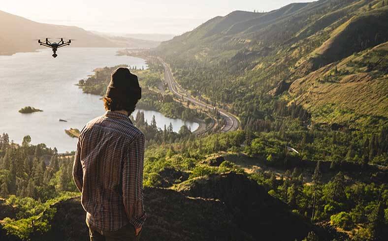
One of the many applications for drones these days is to survey land, an essential task for owners of large ranches, people in charge of taking care of cattle, realtors looking to sell rural land and property, National Park Service rangers or farmers evaluating soil quality, among various other uses.
Drones have simplified the way in which these tasks are performed. However, not all drones are able to deliver the same quality of footage.
For example, you might think that image quality depends only on the drone’s camera, but there are a number of other factors that contribute: namely, the stability provided by the drone, the angles offered through a good gimbal, available flying time, and the precision you get with an FPV—”first-person view”—kit.
What should you look for in a drone if you’re in the business of land surveying?
Land surveying is one of the top challenges for drone manufacturers, because this task requires superior stability, better operating time and device range, superb image quality and ease of flight operation.
So with these needs in mind, here’s my rundown of these key features to help you find the right drone for your business needs.
Stability
This is critical not just for the land industry, but for all tasks conducted by a drone. Stability makes the drone move and stay in the direction you command from the transmitter. It is achieved in drones with the use of a gyro, and usually a six-axis gyro provides all the stability and freedom you need.
Some of the most advanced devices, meanwhile, use sensors, GPS satellite positioning technology and other amazing electronics to give you precision stability at all times.
Operating time and flying range
Operating time is one of the biggest concerns in the drone industry, since today’s battery technology supports flying time of only five to ten minutes in most cases.
As you can imagine, this time may not be enough to perform anything close to an adequate land survey. Luckily, some of the most advanced drones in the market right now deliver up to 30 minutes of flight.
However, it is always a great idea to buy extra batteries to ensure enough total flight time to complete all the tasks you need to undertake. Keep in mind that charging time for each battery pack may be up to 150 minutes.
In terms of flight range, it is best to have a drone that can operate for miles without losing connection with the transmitter. Also, in case you lose sight and want to get the drone back, a return-home function is also desirable.
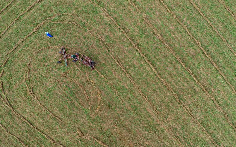
Image quality
As I mentioned earlier, image quality is the result of a combination of factors, the first one being the type of camera the drone can use.
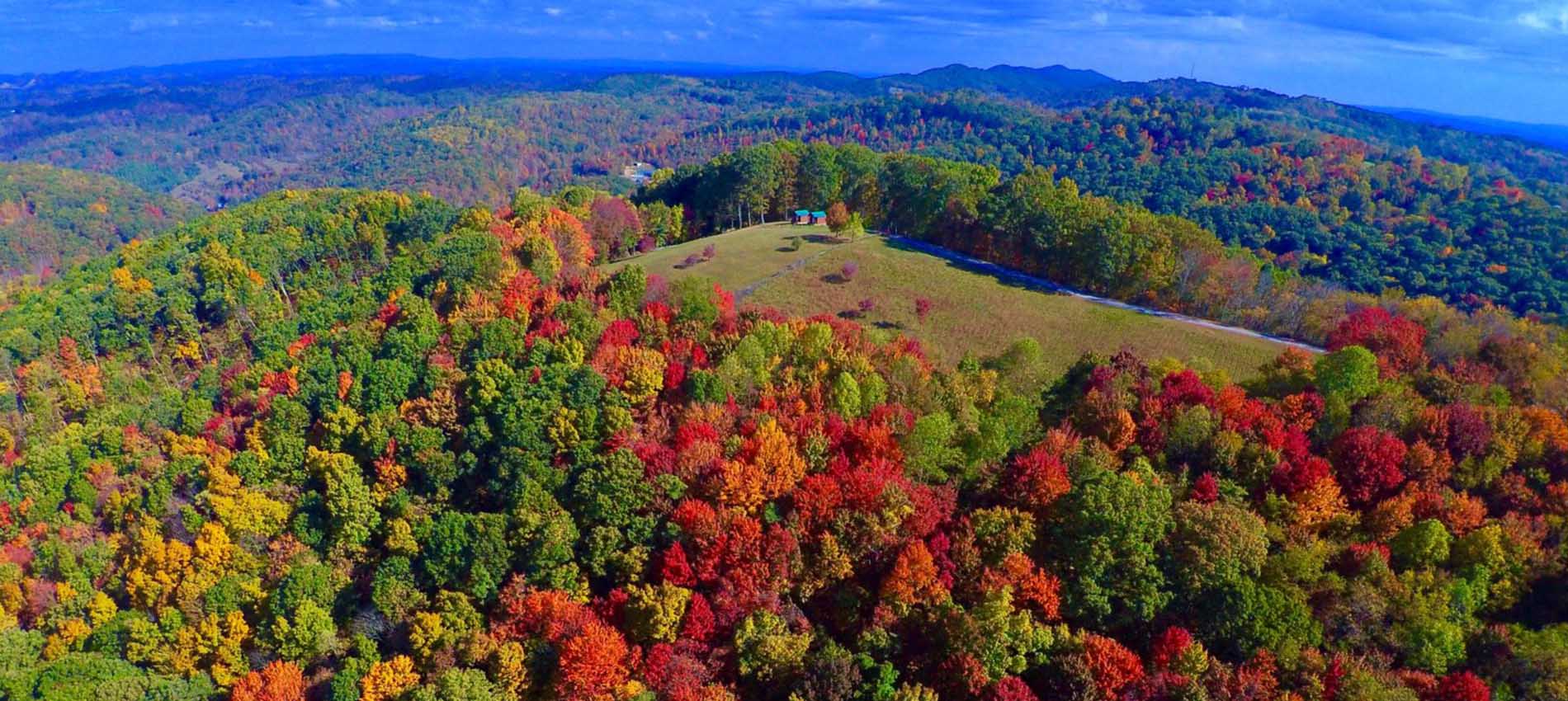
Most cheap drones today offer HD (720p) image quality, though this may not be sufficient for the type of work you need to deliver. This is why some of the top drones in the market today offer the possibility to record footage in UHD (4K).
You will also want to consider a drone fitted with a gimbal, which is a structure that’s used to mount the camera on the drone. The gimbal can be controlled from the transmitter and allows the camera to take a greater range of shots and angles.
An First Person View (FPV) kit is also a must. It can either be a pair of goggles that receive the live image directly from the camera, or a small screen that is attached to the transmitter, so you can see what the drone is seeing while it is flying.
The FPV kit allows you to have better precision in your land surveying activities because otherwise you won’t know what the camera is filming until the very end of the flight’s battery charge. As you can imagine, the last thing you want to happen is to spend 30 minutes exploring an area of land only to discover that:
- You missed a part of the ranch;
- The angle of the image is not the correct one;
- You wasted 30 minutes of battery life, plus the 150 minutes that took to charge, plus the 150 minutes it will take to charge it again, plus another 30 minutes to redo the whole land survey (considering that 30 minutes are enough to survey the whole property).
If you don’t have extra batteries (charged) with you at that given moment, a simple back-of-the-envelope calculation suggests you are looking at wasting about 400 minutes (over six hours!) of your time based of the lack of an FPV system—and we are not counting the time it will take you to drive to the property as well as any analysis or editing you do with the footage. So yes, budget for an FPV kit!
Ease of operation
Drones are not very hard to fly, but a slight learning curve is required when it comes to the cheaper models. Land surveying, however, will require not only a user-friendly unit, but also one that can do a few things on its own.
This is why some of the top drones in the market today offer additional flying aides programmed into the device. Others use sensors to avoid obstacles and remain in the air.
Some drones can be programmed to follow a specific route, which is really helpful in some cases. This isn’t to say that the drone can be left to its own devices (since that is not flying safe), but the interaction with the pilot is a friendlier one.
Look for different flight modes when purchasing your drone, to make sure that you’ll get a device that comes with some of these auto-modes as well as the obstacle-avoiding feature.
The rule of thumb with drones is this: The more expensive the drone, the easier it will be to fly.
Do you have any recommendations for top drones in the market?
This article wouldn’t be complete without mentioning some of the best drones for conducting land and property surveys as well as other aerial photography-related activities.
Everyone seems to have their favorite device or model, but I have ranked these four options based not just on my own research and experience with each, but also based on the opinions of other customers who have their own exacting drone-selection criteria.
DJI Phantom 4 Pro
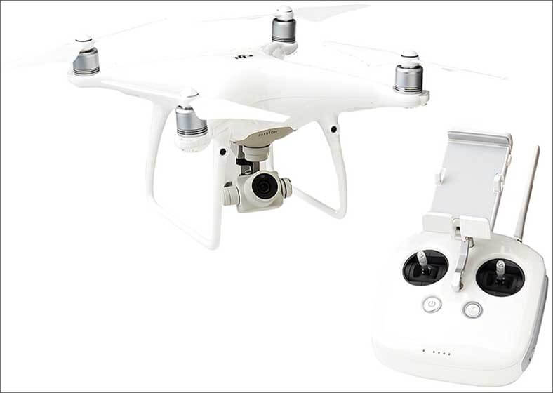
The Phantom model is one of the first drones that appeared in the market. This is the fourth edition of the DJI drone that changed the drone industry forever.
The Phantom 4 Pro comes with a 4K camera and will livestream video directly to your smartphone or tablet, so you already have the FPV system when the order arrives.
This quadcopter comes with all the electronics to avoid obstacles when the drone is flying in auto mode. Simply draw a route on the screen of your tablet and the drone will follow the path by itself, all while the sensors keep it safe from obstacles.
The Phantom 4 comes with a gimbal that will allow you to take amazing shots. Also, with the auto mode, the drone takes care of the flight so you can take care of the photos and videos. This drone also allows you to save everything into SD cards.
The flight time is up to 30 minutes and the batteries take approximately 90 minutes to recharge. Flight precision can be achieved using the GPS flight mode, which will help you get some really sharp images.
Distance range is seven kilometers or up to five miles, and if for any reason the drone loses the connection with the transmitter, the drone will automatically return to the place from where it took off.
Last but not least, I can say that this is one of the easiest drones to fly, thanks to all the aids and embedded electronics DJI has put into this device. It is definitely my favorite pick.
DJI Mavic Pro

The Mavic Pro is another of the big winners in the field of advanced-level drones. This is a foldable drone designed by DJI, which makes it super portable, something that is always appreciated.
It comes with a 4K camera attached to an integrated gimbal, which will allow you to capture amazing video and images.
Flight autonomy is the name of the technology this drone uses to avoid obstacles. It also allows you to focus on getting the best image while the drone takes care of the business of flying itself.
The Mavic Pro comes with a smartphone holder on the remote control, so the FPV is not an issue with this drone.
Just as with the Phantom 4, the Mavic comes with a distance range of up to five miles. If for any reason the drone loses connection with the transmitter, the drone will get back to the place where it took off automatically.
This drone, too, offers flying time of up to 30 minutes and the batteries take approximately 120 minutes to recharge. Flight precision can be achieved using the GPS flight mode, which will help you get sharp images.
Thanks to its foldable and compact design, the Mavic Pro rates highly among consumers for everything from travel to adventure sports to business uses.
Autel Robotics X-Star Premium Drone
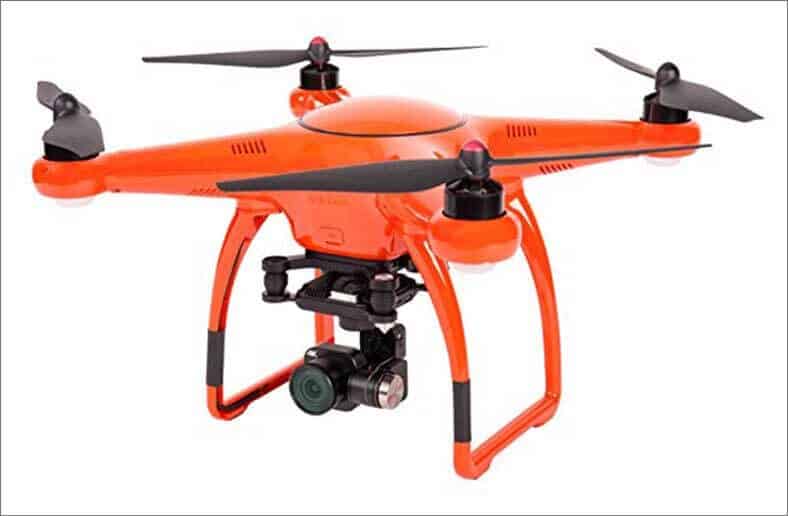
This is a very similar drone to the DJI Phantom 4 Pro in the shape, but its bright orange color aids in spotting the unit in the air, since the color does not mix with the sky or clouds.
It also comes with a 4K camera that fits to a gimbal that comes included in the package as well. This gimbal allows you to take images of 108 degrees without having to rotate the drone.
The FPV system as well is accessed using a smartphone holder that’s attached to the remote control.
Stability is reached thanks to the autonomous flight mode and the dual GPS/GLONASS satellite positioning systems.
The flight time is 25 minutes and the battery will take another 90 minutes to recharge. The operational range is of 1.9 kilometers or 1.2 miles, so significantly less than the DJI ones.
In summary, the X-Star Prime drone is another of the top players in the market right now.
Yuneec Typhoon H Pro
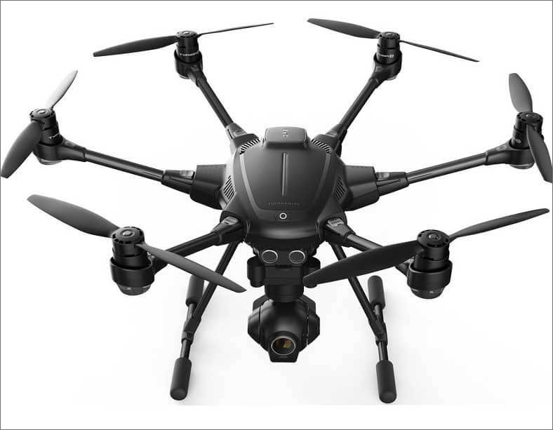
The Typhoon H Pro comes with some great features that professional drone pilots love. Among them, the multiple intelligent flight modes, outlined below
First things first, the camera is a 4K unit and it comes with a gimbal that allows you to capture great shots.
The remote control comes with an embedded screen that will help you get the FPV.
Flight time is 25 minutes and the battery will recharge after another 150 minutes. The operational range is of 1.6 kilometers, or one mile.
Stability is achieved thanks to the Typhoon H’s Intel RealSense technology with collision-avoidance capabilities.
About the multiple intelligent flight modes, there are six of these, as follows:
- Orbit Me: The drone will fly in a circular path around you, keeping the camera on you all the time.
- Point of Interest: Select a subject and the Typhoon will orbit that subject autonomously.
- Journey: The drone will go up and out, as far as 150 feet, and capture the perfect aerial selfie.
- Curve Cable Cam: Easily program an invisible route for the Typhoon to follow and the drone will do it while you control the camera independently.
- Follow Me/Watch Me: This feature will allow the drone to follow and point the camera on you, wherever you go.
- Dynamic Return to Home: Simply switch to Home Mode and Typhoon H will return and land within 26 feet (eight meters) of you.
A great drone if you ask me.
So, what’s next?
If you happen to have a drone already and want to take it to the next level, any of the above four options will do the trick. For those of you who have been wondering lately about getting a drone, these are some of the best options you can find in the market.
If your budget right now is not enough for one of these options, then you can still consider some more affordable alternatives, but make sure you look for the features I mentioned at the beginning of this article as integral to whatever kind of land surveying you are undertaking.
Last but not least, drop us a line or two here with your comments about this post. Let us know your thoughts and if there is anything you would like to add to the conversation. Also, share this with people in your social networks so they can learn more about the best drones in the market for land surveying right now!