As a ranch broker, I am routinely asked about the carrying capacity of ranches. I always struggle to answer this question both quickly and accurately. However, it is an extremely important question when a ranch buyer is contemplating a move that will impact not only their own future but potentially the fortunes of future generations.
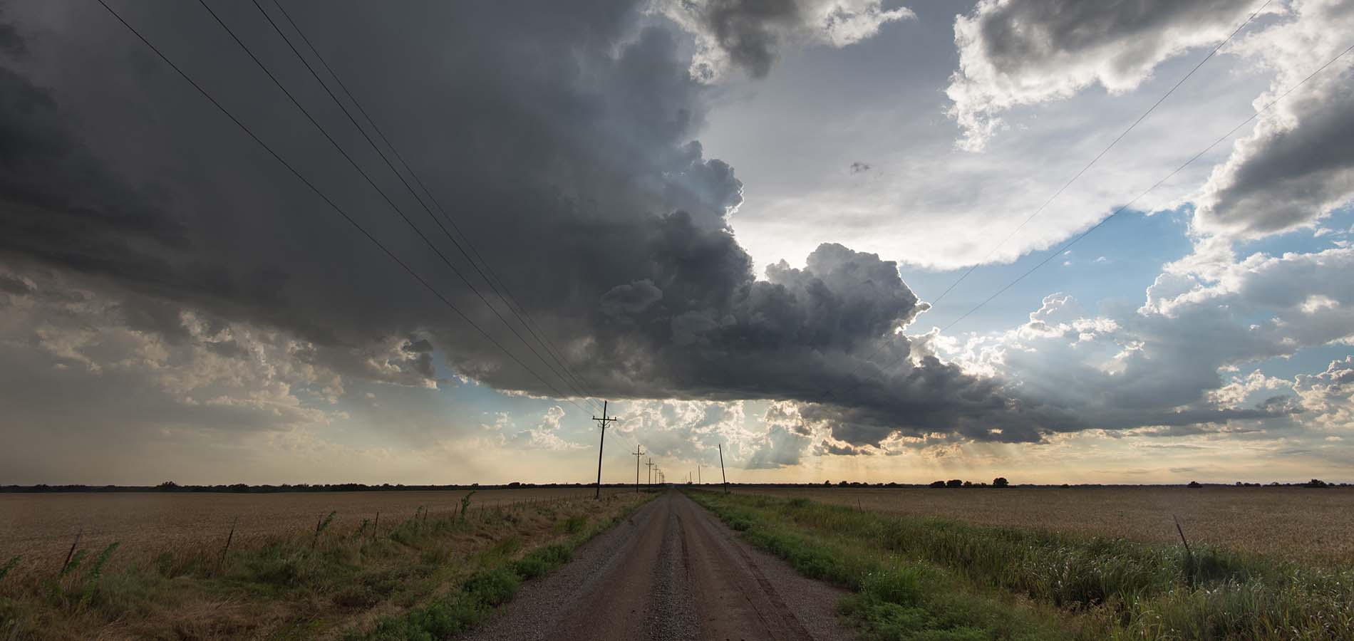
It’s easy to become mesmerized by the beauty and productivity of Oklahoma ranches in the spring—but it seldom lasts.
Often, I read ranch descriptions that say a ranch will run a certain number of cow/calf pairs or has a large population of deer. I myself have been guilty of writing such over-simplified statements, but I always try to qualify them with statements such as, “on a good year” or “on average”. When it comes to weather, in particular, it’s critical to understand the patterns to evaluate what affect it’ll have on the land and its potential.
What past weather patterns can tell us about future extreme events
Here in Oklahoma we have a short-term drought almost every year (see below). From January until May, the increase in rainfall and temperature trend upward together. The result being that springtime pastures look magnificent blanketed with thick, lush cool-season grasses from late March until early June. It’s easy to become mesmerized by the beauty and productivity of Oklahoma ranches in the spring—but it seldom lasts.
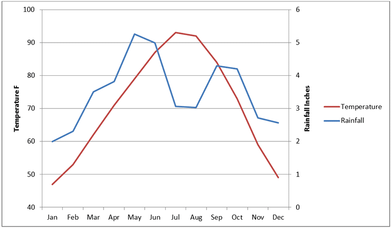
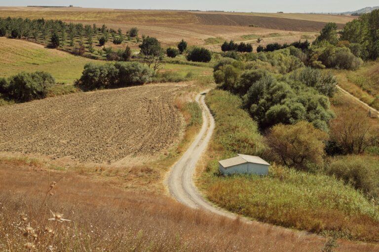
As the temperatures ramp up in July, the frequent spring rains suddenly stop. When those 100-degree days hit and there isn’t a cloud in sight, soil moisture drops like a rock and upland pastures start to make that “crunchy” sound when you drive across them. Fortunately for us, though, most Oklahoma ranches have a fair amount of bottomland along creeks and rivers, which holds moisture longer and sustains warm-season grasses until the rain and cooler weather returns in September. All in all, most years we can slide right through with no real issues. But what happens when these baby droughts start to grow into real ones?
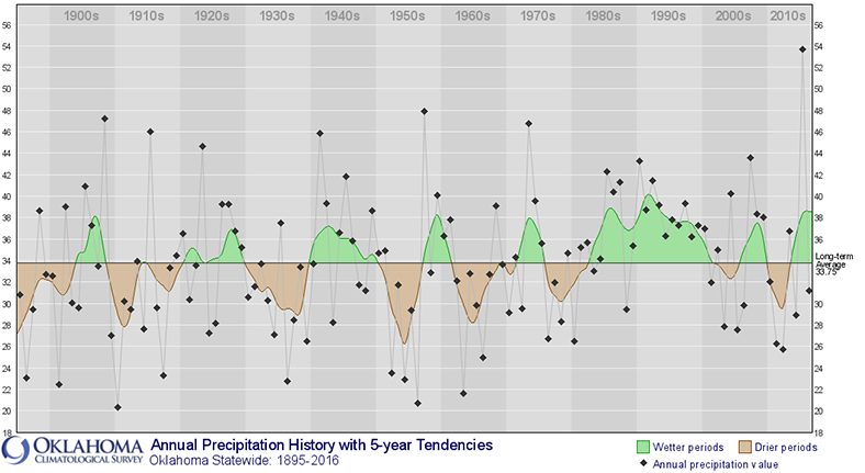
When you look back at the weather data collected over the last century in Oklahoma (see chart above), one thing stands out: droughts are not uncommon. Indeed, they should be expected. A more subtle point—and perhaps a much more important one—is that temperature trends play a key role in the impact of droughts (see below).
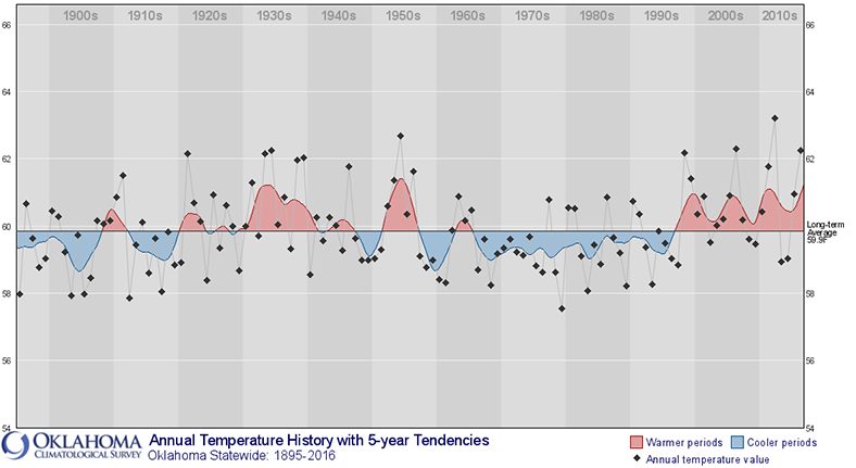
Take for example the Dust Bowl of the 1930s. This drought was so severe and widespread that it became part of the collective consciousness of the country. It quite literally devastated the land as the lack of rainfall and above-average temperatures desiccated the soil. But has anyone ever heard of the drought of the 1910s? Looking at the rainfall table above, the dry years were just as dry, if not drier, than during the Dust Bowl. In fact, it actually persisted slightly longer. Why haven’t we heard of this drought? Mainly because the temperatures were below normal. One can postulate that during the Dust Bowl, extreme temperatures and lack of rainfall accelerated the loss of soil moisture and resulted in vegetative stress and death faster than during the 1910s event—resulting in a far more destructive drought.
In short, cool and dry spells are bad, but hot and dry spells are far worse. Although primarily only known locally, the drought of the 1950s here in Oklahoma is commonly remembered, whereas I’ve never heard anyone mention the drought of the 1960s. Here again we see the same scenario: Hot and dry equals destructive and memorable, while cooler and drier is less remarkable, relatively-speaking.
How weather patterns drive ranch selection
Obviously, the weather affects everything that lives under the sun, so whether you are in the market for a recreational or a working ranch, these weather patterns will affect your animals, wild or domestic. Since we can’t change the weather, it always pays to study weather patterns to find the best ranch locations. For example, if we start out looking at rainfall for Oklahoma as as example, you see a strong decrease in rainfall the state from the humid southeast to the arid northwest.
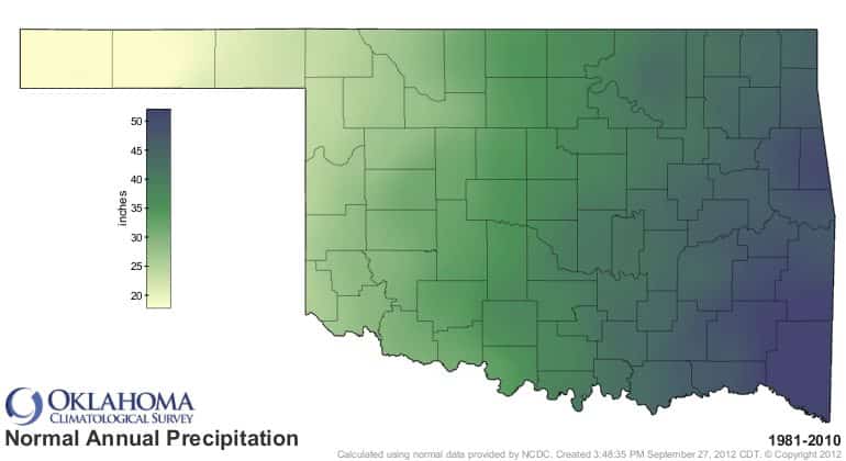
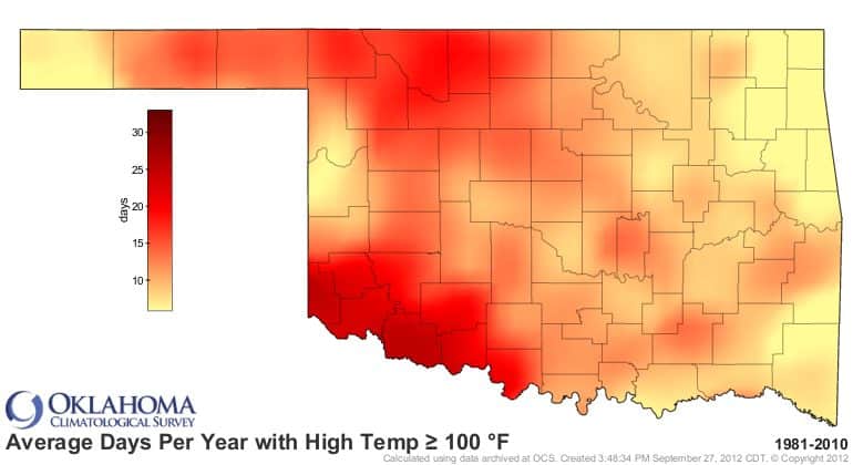
The same trend is seen in temperature patterns, too, with the number of 100-degree Fahrenheit days occurring far more frequently in the west than the east. In fact, you can generally divide Oklahoma in half down a north-south through Oklahoma City along Interstate 35; east of I-35 trends wetter and cooler, west is hotter and drier.
Other ranch-selection factors beyond weather
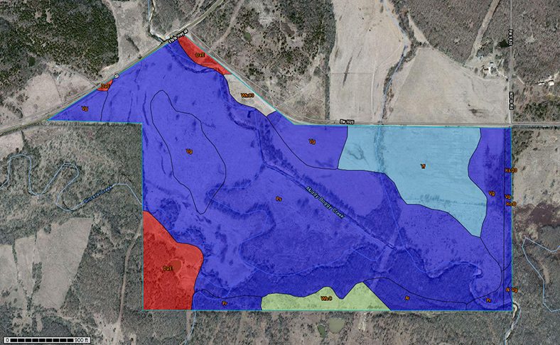
Consequently, when it comes to avoiding destructive droughts, the advice may as well be, “Go east young man, go east!” Of course, that doesn’t simply mean that all land east of Interstate 35 is better. Soils play an equally large role in selecting a ranch. The soil map below denotes how soil types and thickness change across different parts of a ranch. Lower elevation typically equals thicker, richer soils (in blue) that capable of holding more moisture, while higher elevations are more likely to consist of thin, rocky soils (in red) that are consequently impacted by drought more quickly.
However, a wild card in the equation is the occurrence of ground water that maintains the flow of streams, creeks and rivers during drought. A good example of this is the Arbuckle Simpson Aquifer located between the Oklahoma towns of Ada, Ardmore and Toshomingo. This karst aquifer feeds a vast network of springs that can mitigate drought impacts on stream flows and bottomland soil moisture.
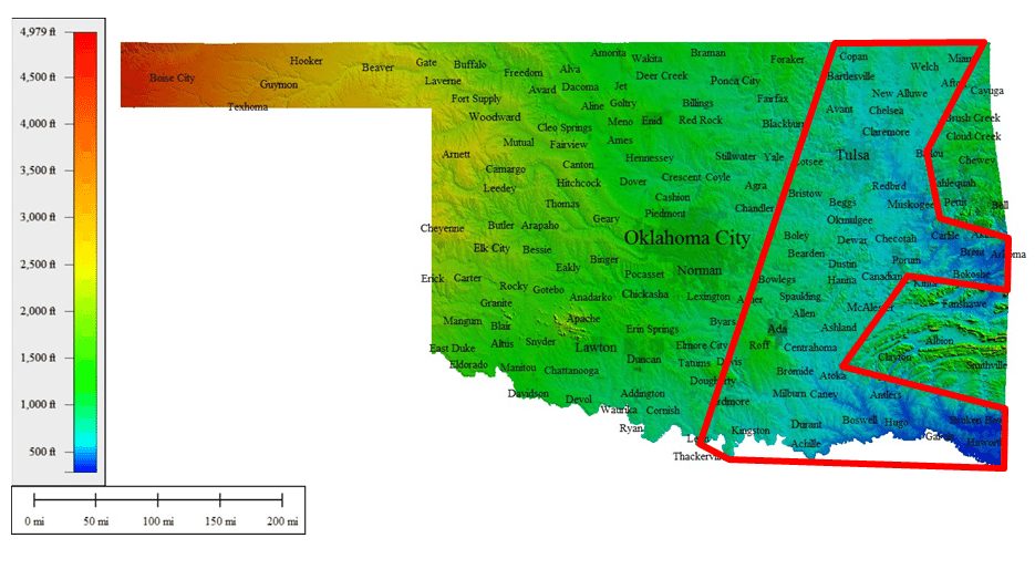
When all of these factors are considered, a fairly recognizable sweet spot (outlined in red on map below) for ranching in Oklahoma becomes obvious. This area runs generally north to south, tilted slightly to the northeast, lies east of Interstate 35 but excludes the Ozark and Ouachita highlands. This region is characterized by relatively high rainfall, fewer 100-degree days, thicker bottomland soils and, in some locations, significant springs.
Although no area is drought-proof unless you have the ability to irrigate indefinitely, the type of analysis of the available information as outlined above can help ranch buyers to identify regions less likely to suffer from devastating droughts. This type of analysis can be conducted for other states and once the search has been limited to the best region(s), then a finer scale search can be conducted to find those ranches that have a higher ratio of bottomland to upland in order to find the most drought-resistant property available.
