We confess: We could spend hours poring over images of beautiful property and land for sale amidst some of the most stunning, sought-after country around the United States. With that in mind, it’s always a thrill to discover something that captures that same excitement and passion for the land on which we work, play, live and thrive. Case in point: this post by NASA technical writer Adam Voiland, “Reading the ABCs from Space,” that catalogs 26 land formations captured by NASA satellites that represent the letters of the alphabet. Take a bow, Mother Nature: sometimes a picture is worth a thousand words—or, ahem, 26 letters. Visit NASA’s Earth Observatory to see the full A to Z of satellite imagery.
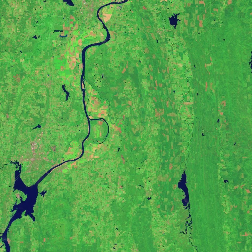
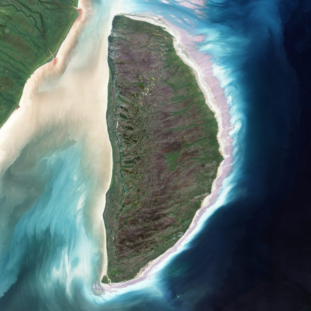
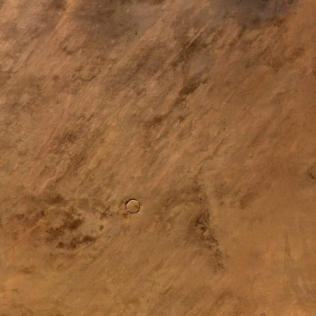
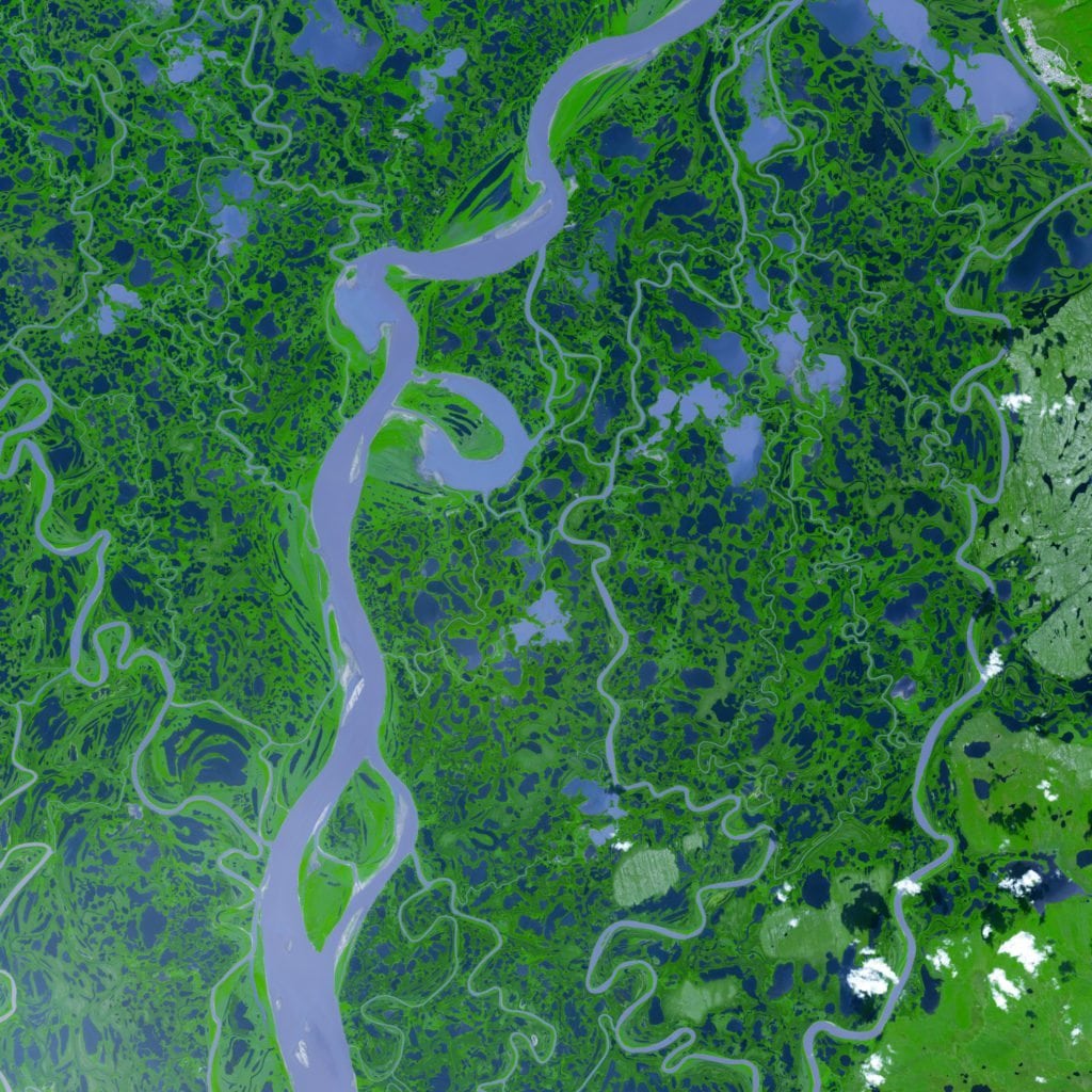
The Arkansas River snakes through Arkansas’ Holla Bend Wildlife Refuge, supporting migratory geese, ducks and other waterfowl, not to mention thousands of acres of agricultural and recreational land. This image was captured by NASA’s Landsat 8 satellite on August 4, 2014. (NASA Earth Observatory)NASA’s Landsat 7 satellite acquired this image of Akimiski Island in James Bay, Ontario, on August 9, 2000. (NASA Earth Observatory)Located in the Sahara Desert, Mauritania’s Tenoumer Crater was formed when a meteorite struck the earth between 10,000 and 30,000 years ago. This image was captured by NASA’s Terra satellite on January 24, 2008. (NASA Earth Observatory)This false-color image of the Mackenzie River Delta in Canada was captured on August 4, 2005, by NASA’s Terra satellite (NASA image courtesy GSFC/METI/ERSDAC/JAROS, and the U.S./Japan ASTER Science Team)