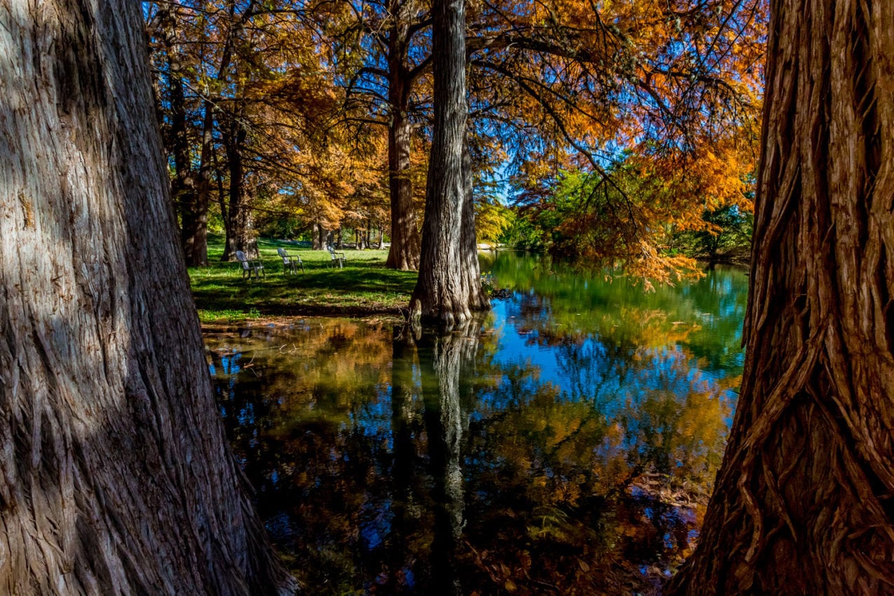
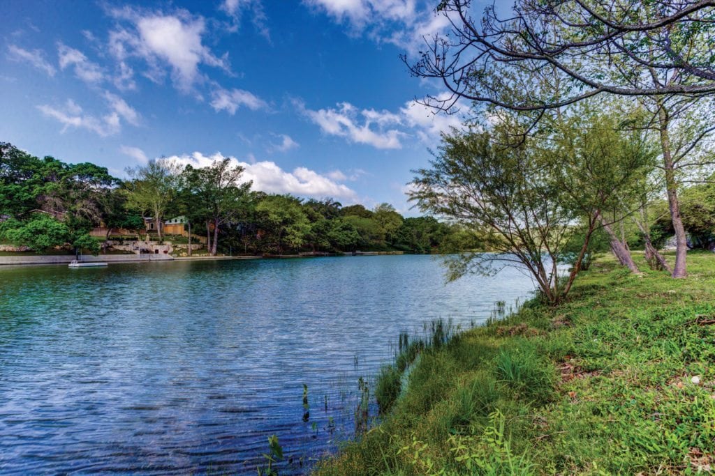
The Guadalupe River rises in two forks in western Kerr County. Its North Fork begins just south of State Highway 41, four miles from the Real-Kerr county line (at 30°06’ N, 99°39’ W), and runs east for 22 miles to its confluence with the South Fork, near Hunt (at 30°04’ N, 99°20’ W). The South Fork rises three miles southwest of the intersection of State Highway 39 and Farm Road 187 (at 29°56’ N, 99°35’ W) and runs northeastfor 20 miles to meet the North Fork. After the two branches converge, the Guadalupe River proper flows southeast for 230 miles, passing through Kerr, Kendall, Comal, Guadalupe, Gonzales, DeWitt, and Victoria counties. It then forms the boundary between southern Victoria County and Calhoun County and between Calhoun and Refugio counties before reaching its mouth on San Antonio Bay (at 28°26’ N, 96°48’ W). The Guadalupe’s principal tributaries are the Comal and the San Marcos rivers. Its drainage area is about 6,070 square miles. The upper Guadalupe flows across part of the Edwards Plateau. Near the river, high limestone bluffs support bald cypress, mesquite, and grasses. The Balcones fault line, which the river crosses near New Braunfels, marks the transition to the coastal plains. Sections of the upper and middle reaches of the river are suitable for canoeing, but a number of small waterfalls prevent uninterrupted navigation of the entire river. The lower Guadalupe is generally much quieter and has more sand bars that lend themselves to camping and day use.
The name Guadalupe, or Nuestra Señora de Guadalupe, has been applied to the present river, at least in its lower course, since 1689, when the stream was so named by Alonso De León. Domingo Terán de los Ríos, who maintained acolony on the river from 1691 to 1693, renamed it San Agustín, but the name Guadalupe continued to be used. Most of the early explorers, including Father Isidro Félix de Espinosa, Domingo Ramón, and the Marqués de Aguayo, called the Guadalupe River the San Ybón above its junction with the Comal, and referred to the Comal River as the Guadalupe. Above the mouth of the Comal the name Guadalupe was applied to the present river at least as early as 1727, when Pedro de Rivera y Villalón so referred to it.
Artifacts dating from the Archaic era have been found in the Guadalupe River valley, suggesting that the area has supported human habitation for several thousand years. The peoples encountered by early explorers belonged to the Tonkawa, Waco, Lipan Apache, and Karankawa Indians. These early inhabitants were gradually displaced by settlers from Mexico, Europe, and the United States. European settlement along the Guadalupe began as early as the 1720s, when the Spanish established several missions above the site of present Victoria. In 1755 the short-lived San Xavier Mission was established near San Marcos Springs. For a brief time in 1808 a settlement grew up at the intersection of the Guadalupe River and the Old San Antonio Road, but flooding and the threat of Indian raids made the site untenable. Settlements of a more permanent nature along the Guadalupe were not long in coming, however. Martín De León established Victoria near the mouth of the river in 1824, and in 1825 James Kerr founded Gonzales 60 miles further upstream, where on the south bank a historic marker has been placed to commemorate the firing of the first shot for Texas independence in the battle of Gonzales (October 2, 1835). During the 1830s some 30 or 40 families homesteaded along the banks of the lower Guadalupe, which was an early boundary of the Power and Hewetson colony. Settlement farther upriver increased in the late 1830s. Seguin (then called Walnut Springs) was surveyed by Benjamin McCulloch in 1839, and New Braunfels was founded in 1845 by a group of German settlers led by Prince Carl of Solms-Braunfels. In 1856 Kerrville was established on the upper Guadalupe. The construction of railroads through the middle and upper Guadalupe valley in the 1880s brought large numbers of new residents to the area. Kerrville, Comfort, Luling, and Cuero were among the small communities on the Guadalupe that prospered with the arrival of the railroads.

Projects to make the Guadalupe navigable were approved by the Mexican government in the late 1820s and early 1830s, but these were interrupted by the Texas Revolution. Some improvements to the lower reaches of the river were authorized by the Republic of Texas in the 1840s and by the Texas legislature in the 1850s. Large snags in the Guadalupe above Victoria made travel upriver impossible, but commercial routes were developed from Victoria to ports on the Gulf of Mexico. River traffic declined after the completion of the San Antonio and Mexican Gulf Railway from Victoria to Port Lavaca in 1861. Interest in the river’s potential navigability was renewed in the early 1900s, but a 1935 study by the United States Army Corps of Engineers pronounced such a project economically unfeasible. Instead, the corps proposed a canal paralleling the river to connect Victoria with the Gulf Intracoastal Waterway. The proposal was reviewed in 1950, and construction began soon thereafter. The 35-mile Victoria Barge Canal was opened to commercial traffic in the mid-1960s, thus eliminating the need to improve the Guadalupe itself for such a purpose.
The steady flow from the springs that feed the Guadalupe and its tributaries have made the river an attractive source of waterpower. The Guadalupe Waterpower Company was established in 1912, and by 1920 the company had built a series of dams between New Braunfels and Seguin in an effort to harness the river’s power. Flooding, however, continued to be a problem. In 1933 the state legislature established the Guadalupe-Blanco River Authority to oversee the control, storage, and distribution of water from the Guadalupe and Blanco rivers. In 1958 the corps of engineers, in cooperation with the river authority, began construction of the dam at Canyon Lake several miles upriver from New Braunfels. After its completion in 1964, the dam provided the first effective flood control for areas downstream. During the early 1990s the Guadalupe River continued to play a critical role in providing the surrounding area with power, water, and recreation. Kerrville, New Braunfels, San Marcos, Seguin, Gonzales, and Victoria, as well as smaller communities such as Prairie Lea and Fentress, relied on the river for their municipal water supply. At least six power stations in the middle and lower portions of the river depended on a steady release of water from Canyon Dam, and the construction of several more such stations was under consideration. Recreation on the river, which included canoeing and inner-tubing as well as water parks and the facilities available at Canyon Lake and Guadalupe River State Park, attracted large numbers of people to the vicinity and contributed heavily to the area’s economy.