We recently surveyed a large tract of land in North Georgia that had never been surveyed. A relative of the owner was getting ready to place the property up for sale to distribute amongst the heirs and thought that they had 163 acres. The deed said 163 acres, the tax assessors record confirmed the number and, lastly, the GIS map online said so, too. Checking the GIS map, it even roughly calculated a closed polygon to be about 163 acres.
These were the official records for this property for the last 75 years. So, it must be true, right?
Thankfully, the relative taking care of business had some foresight and thought that having the property surveyed before placing it on the market would be a good way to “spruce up” the listing.
Hire a professional, board-certified land surveyor. Hiring anyone else would be the same as getting your teeth pulled by the local butcher; there’s lots of screaming and he might pull the wrong tooth.
It’s been illustrated in the past that commissioning a land survey helps buyers avoid uncertain expectations about where boundaries are by defining the area of land based on standard surveying protocols. A survey thereby secures the highest possible asking price for the seller and commission for the agent, plus provides valuable knowledge to the current owner as to whether he should remove that encroaching fence himself or politely ask his neighbor to do it. And, of course, it affirms if the yearly tax bill is accurate based on the area!
A word of caution: Don’t ever consider hiring your mother’s uncle brother’s friend who once worked on a survey crew for the summer to survey your family’s assets or future assets. It’s dangerous and deceptive and will cause all kinds of trouble. Hire a professional, board-certified land surveyor. Hiring anyone else would be the same as getting your teeth pulled by the local butcher; there’s lots of screaming and he might pull the wrong tooth.
Back to our North Georgia land survey: we were hired and so another journey to find the truth began by piecing the correct parts of the puzzle together.
First, we gathered as much research as we could find both online and by visiting the county courthouse for the subject property, including easements and rights-of-way plus all the tracts of land that touched the subject property. If not enough descriptive deeds or records were found, we enlarged our circle to include the next tier of properties. We asked the current property owner for any land records, deeds or plats that they might have. Also, we interviewed the neighboring property owners. Adjacent property owners are usually cooperative in supplying any land records they have on hand because they can also get the common line with their neighbor defined at no charge to them.
There are times where oral testimony is needed, too, especially for large tracts of land that have been in the family for generations. Your great-grandfather and his brothers may have clearly defined a fenced-off area for raising cattle located 200 feet inside the property, but then they used the centerline of a second creek as the boundary. Since fences don’t always run along the exterior property lines, it can become rather complex and these boundaries are not always obvious.
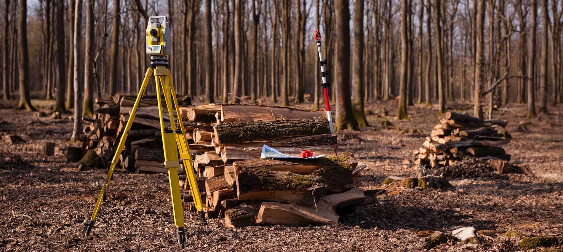
After piecing together as much as we could find on paper, our field crews then headed out to the property and started searching for monuments, both natural and artificial. Natural monuments might be something like a rock outcropping with an ‘X’ etched in it, a bearing tree, a body of water or a ridgeline. Artificial monuments might be something like an iron pin—affectionally called “stobs” by property owners, I don’t know why—set by a surveyor, a road, a witness post, a wheel axle, and so forth.
After the initial reconnaissance was completed, a traverse was set up close to the exterior boundaries. A traverse is a meandering trail that surveyors leapfrog from one point to the next using their equipment to then locate property corners, monuments and land features like fences, rock walls, roads or anything that’s close to the boundary lines. The traverse line is sometimes confusing to property owners, who assume that it might be the actual location of the property lines. Note: it’s for the surveyor’s reference only! If you see a meandering path like this in the woods or on your property, do not disturb it as it will cost more time and money to replace that point in the correct location again. (And yes, we can tell if a traverse point or property corner has been moved.)
I hope that this helps to dispel the urban legend that whoever hires the land surveyor will always come out on top of his neighbors or any dispute. Land surveyors are always committed to seeking the truth, no matter who pays.
After traversing around the exterior boundaries, running up very steep hills loaded down with equipment, water jugs and mushy sandwiches, we collected the field data, including the actual road location, so not a skewed and distorted projection that is often seen on GIS maps. Calculations are done in the field to make sure that the created polygon around the boundary closes within a certain accuracy, after which the field crew heads back to the office. Once the data hit the office, our final calculations showed the area to contain 177 acres—14 acres more than originally thought.
In real money, if the local price of land is, say, about $3,000 per acre, that roughly translates into $42,000 more in asking price, not to mention increased commission for the real estate agent.
Of course, at this point, you might be thinking that this could have gone the other way and the property would have come out with a lesser area. This does happen and it’s most often revealed from a land survey after the property has been in the family for a couple of decades, with the deed quietly resting amongst its companion papers only to be challenged by a future land surveyor. Imagine the look on father’s face after learning he has only owned 73 acres all of this time and not the 130 acres he thought (plus he has been taxed for 130 acres). And he’s promised his kids for years that they’ll each receive 40 acres as their inheritance. I’ve seen this look of shock and sheer sadness more than once, and it puts a knot in my stomach. I hope that this helps to dispel the urban legend that whoever hires the land surveyor will always come out on top of his neighbors or any dispute. Land surveyors are always committed to seeking the truth, no matter who pays.
To circle back around to the deed, it’s important to understand how discrepancies in a given land area can happen. For metes and bounds property, let’s consider a couple things. The deed mentions a road (bounds) but fails to describe that it’s shaped like a very curvy and lazy river but with no directions or distances along said road. The deed also mentions property as held by previous property owners and forestry land, but that’s it. So, at some point in the past, one person (let’s call him Mr. Green) describes his piece of property based on a ridgeline and road and bounded by Mr. Brown’s cattle farm to the east, or some other feature, but no one bothers to actually get it surveyed.
As the decades roll past, a small mountain of research related to the subject property piles up to support Mr. Green’s description, but nothing to validate or prove it that it’s factually correct. The tax assessors take the deed, stamp their approval on the 163 acres, tax it as such and it’s forever in the system. Years later, when GIS becomes the norm, they too take the same storyline and electronically map it for mass consumption and confusion. Because a land surveyor’s hands haven’t touched this property yet, the only record (deed) has to be taken as the sacred text and continues with the incorrect area because it’s based on decades of faulty reporting.
Which brings us to another question: Which comes first, the deed or the survey? Deeds are the written description of the surveyed land. However, with older deeds and no land surveys of record, descriptions of what’s on the ground are often based on which neighbor touches your land—and that’s it. That leaves a lot of room for interpretation. Metes and Bounds states, which are the 13 original colonies and most of Texas, can be described this way, containing what I like to call “The Blob” of land—aka, a piece of land that has an irregular shape in addition to regular shapes. The Public Land Survey System describes land by range, township, block, lot and areas mostly shaped in nice squares or rectangles, which are not as easily misconstrued.
Who determines the boundaries of the land? Mr. Green, the tax assessor or the local GIS department? None of the above. Only licensed professional land surveyors can determine the property lines. This determination is based on public and private research, field data and statistical analysis, knowledge of local land history and, of course, lots of experience. Part science and definitely an art.
Our founding fathers, men like George Washington, are often cited as having “great wisdom” and several were land surveyors themselves, not only to lay out towns like Washington, D.C., but also to keep an official record of their own vast estates. Washington’s 8,000 acres at Mount Vernon were complemented by more than 50,000 acres in the western portions of Virginia and what is now West Virginia, while Thomas Jefferson inherited approximately 5,000 acres of land, including his mountaintop estate at Monticello. Well done Mr. Washington and Mr. Jefferson. They too wanted to know exactly where their boundaries lay and how much property they owned.
To finish up, the plat (often called “my plot” by property owners) that we issued on that aforementined land in Georgia showed the boundary lines and descriptions of the property corners, some which we set, some that were found. It showed access to a public right of way, adjacent owners’ names and warranty deed references, tax id number, zoning, any recorded plat references found through our research and, significantly, a huge power easement that wasn’t recorded but clearly crossed the property in a spot not visible from the road.
The plat was drawn and certified to be recorded at the wishes of the property owner (although this recording is not required in the state of Georgia). Those surveys whose plats are recorded have more gravitas to their claim in any possible conflicts as they had to be prepared according to state standards, which are usually very stringent.
The property owner was very grateful that his land was finally clearly defined and had no encroachments or other issues that a survey would have flushed out. He had something visual and legal to hand to potential buyers and he was rewarded with a few “bonus” acres for having hired a professional land surveyor.
Last word on GIS: Get it surveyed!
 About the Author: Cathy Costarides has been a licensed Professional Land Surveyor in Georgia since 1992 and is a second-generation surveyor working in the industry since 1979. She performs land surveys for large tracts of land all over the state of Georgia and can be reached at CC Land Surveyors, Inc.