

When it comes to maps, the Land.com Network has you covered. Our platform integrates with the top property mapping platforms out there, along with providing our own custom map overlays and powerful mapping tools. Below are some highlights for you to consider when you are mapping new land listings.
TerraStridePro Map Integration
TerraStridePro maps can easily be displayed in your property listing. These will display in place of the Land.com Network mapping features, but give full access to your TerraStride property map right in your listing details.
Watch this video for a mapping video tutorial
MapRight Mapping Integration
MapRight integrates right into the map display on your listing, replacing the Google map that would usually show. The viewer has full use of the MapRight display tools, even allowing a full-screen experience.
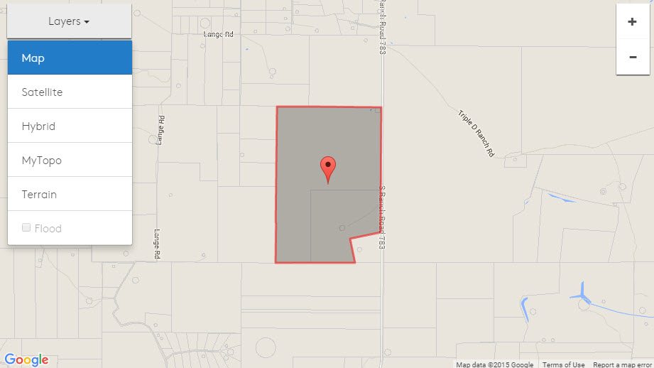
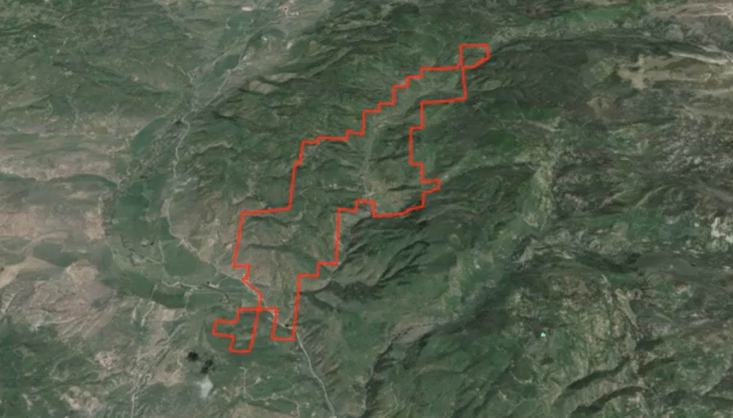
The Land.com Network Property Boundary Tool enables a buyer to look up your property based on lat/long coordinates or from our map search, not just the provided street address.
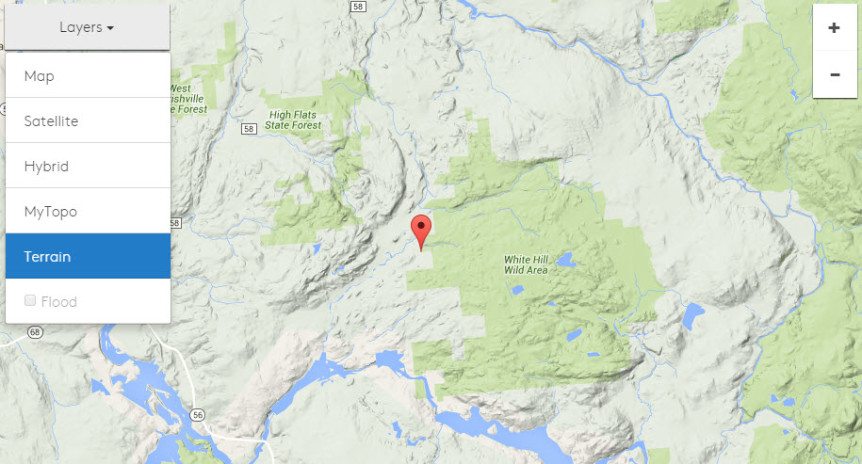
Land.com Network Map Features
The Land.com Network platform supports advance mapping features and display right out of the box—giving sellers a diverse array of property location displays, and land buyers a full, rich experience. Included are street maps, parcel maps, terrain maps, topography maps, satellite images, Google earth flyovers, and custom add-in like location markers, all with a defined property boundary.
Lands of America also provides a boundary mapping tool, so you are able to display a highlighted property boundary overlayed onto each of these map types. Helpful for buyers to understand, especially if the property boundaries differ from the parcels that may be shown. It is very easy for any seller to add a property boundary to their listing in the admin panel. This also enables a buyer to look up your property based on lat/long coordinates or from our map search, not just the provided street address.
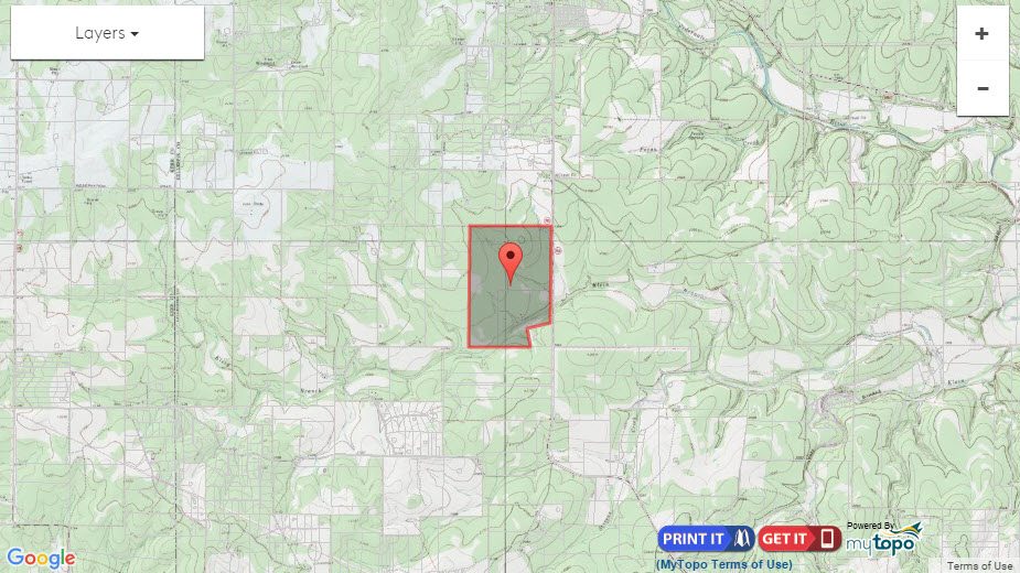
MyTopo Overlay

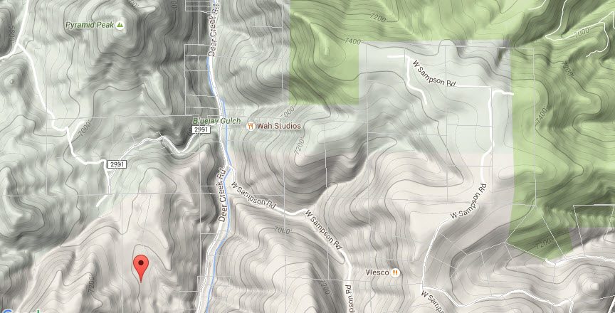
Terrain Map

Google Map

Parcel Maps


Satellite Image
For those who just want to see the land, you can observe vegetation cover, property and structure layout, roads and more from a satellite map. This map also features a parcel overlay, and can be shown with or without roads.
Google Earth enabled

Interior Mapping
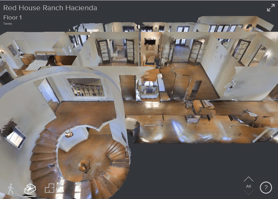

Lands of America also integrates with Matterport for interior mapping of homes. Complete 3D walk-throughs, real floor plan maps, and their ‘doll-house view’, a buyer can do a complete walk through tour of your residence from their computer.
The 360-degree virtual tours act just like Google Map’s ‘Street View’, but within the property dwelling. This technology also provides a total realistic blueprint of the interior in a three dimensional floor plan.