Rural appraisers will go a country mile to figure out what your property is worth.
They’ll drive across state to measure buildings, estimate crop values, and count livestock and equipment.
They’ll brave snakes and all kinds of weather to inventory trees in a timber stand.
And they’ll figure out property value based on the type of agriculture, nearest city, ducks flying overhead or oil flowing underneath.
While appraisers have done that for decades, they now do it faster and more accurately thanks to technology.
Seeing Things in a New Way
Aerial photos are now so detailed that appraisers see what makes property more or less desirable—such as water, tree cover, topography and configuration—before they even get there. Multilayered maps show property boundaries, flood zones, easements, soil types, school districts and more. Many resources are available for free from county appraisal districts, soil and water conservation districts, and other public sources.
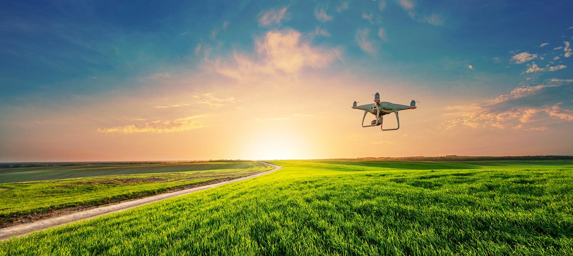
What appraisers can’t inspect on the ground, they can see in very sharp photos and videos from a drone.
“We’re looking at it as though we’re a potential buyer, and what we would pay for the property given its physical attributes,” says Stan Phillips, director of appraisal and a regional vice president for AgTexas Farm Credit Services in Burleson. “We’ve been using a commercial drone in West Texas, where there are sections of land that you can’t drive to. It’s also very beneficial when looking at large-acreage properties, feedlots and buildings under construction.”
Having Data When and Where You Need It
Software and automation put information at appraisers’ fingertips.
For example, when a Farm Credit lending cooperative in Texas closes a real estate loan, the sales price, legal description and other details automatically go in its sales database. Information on outside sales comes from the Lands of America broker network, painting an even bigger picture. Appraisers then use the data to see market trends and compare properties.
“It lets them work smarter instead of harder,” says Brad Swinney, vice president of collateral risk management for Farm Credit Bank of Texas in Austin. The funding bank provides AgWare appraisal software and the broker data to 14 Farm Credit lending co-ops in five states.
Mickey Nixon, Capital Farm Credit’s regional chief appraiser in Lubbock, counts the ways AgWare improves appraisal reporting.
“Gathering and sharing data. Integrating report writing with a database of comparable sales. The ability to auto-populate templates. Access to up-to-date maps and images,” Nixon says. “Those enable an appraiser to write a well-supported report faster, with fewer errors and greater confidence.”
Ensuring Adequate Collateral
With technology carrying part of the load, appraisers can focus on what they do best: understand an immense variety of rural property and agriculture.
The result is that borrowers and lenders have a clear picture of the market value of property—including the collateral backing their loans.
“The appraisal makes sure the price is appropriate for what a customer is purchasing or refinancing,” Phillips says. “I like to think we give them information they need to hear. But our primary role is to mitigate risk. We want to make sound loan decisions based on appraisal, credit and other factors.”
The process also helps lenders maintain the trust of borrowers, regulatory agencies and the public.
“Our appraisals are used to determine collateral value for lending purposes,” Nixon explains. “They tell you that the lender is safe and sound.”
Appraisers’ Top 10 Technologies
- GPS coordinates for pinpoint accuracy
- Geographic information systems (GIS) that display data in layered maps and 3-D scenes
- Up-to-date aerial photographs and property maps
- Mobile hotspots for access to appraisal websites on the road
- Mobile apps that track your location without a cellular signal
- Apps that calculate timber’s value with less time and footwork
- Drones that get a bird’s-eye view of inaccessible areas
- Software for reporting appraisal information and comparing similar properties to arrive at a value
- Databases of accurate sales information gathered by Farm Credit appraisers and automation
- Market trend reports from the Texas A&M University Real Estate Center based on Farm Credit sales data